The geophysical applications in engineering include those in geotechnical engineering, civil engineering, offshore drilling, offshore cable and pipeline route selecting, tunneling, transportation, and construction.
Engineering Applications Page 1: Fault and fracture mapping, Lava tube and mine working locating, Karst features and voids, Tunneling, Permafrost mapping, Rock rippability, Depth to bedrock, Underground utility locating
Slope stability study includes soil, rock, and groundwater condition characterization, faults and fractures mapping, and soil shear strength determination. Seismic refraction, surface wave, downhole seismic, downhole optical televiewer, electrical resistivity imaging, and GPR methods can be used for this purpose.
Soil modulus determination
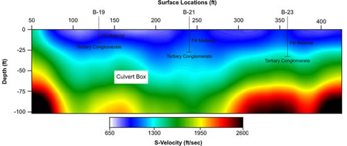
Soil modulus can be determined using downhole seismic VSP, downhole suspension logging, borehole sonic logging, and surface wave methods. These methods provide the velocities of compressional wave and shear wave. An example of shear wave profile obtained with multi-channel analysis of surface wave (MASW) method is shown below:
Offshore geohazards
Offshore geohazards include:
Slope instability
Shallow gas
Gas hydrates
Shallow water flow
Mud diapirism and mud volcanism
Gas and fluid venting forming seafloor pockmarks.
Seismicity, which may trigger slides, cause tsunamis and disturb subsurface geological conditions, e.g. pore pressures.
Side scan sonar, seismic reflection, seismic refraction, and seabed surface wave studies will provide very useful information to characterize the geohazards in the survey area.
Directional drilling
Geophysical methods have been used to characterize the subsurface materials (i.e.: bedrock, boulder, clay) to assist in directional drilling. Commonly used methods are GPR, electrical resistivity imaging, seismic refraction, seismic reflection, and gravity.
Muskeg mapping
The lateral and vertical extent of muskeg can be delineated with GPR, seismic reflection, seismic refraction, and electrical resistivity imaging. Its modulus can be determined with surface wave.
Pavement evaluation
QA/QC of new pavement
QA/QC testing newly constructed pavements with geophysical or NDT methods is desirable because in-situ testing is possible within hours after concrete roads are poured. The methods used are aimed at determining linear elastic modulus (Young's modulus) and thickness. These measurements can also be used for maturity analysis to aid in deciding when a new road can be opened.
Quality Control (QC) may be defined as the implementation, measurement and enforcement of sound construction practices and jobsite inspections to ensure construction quality. In contrast, Quality Assurance (QA) may be defined as the inspection and testing of the completed product, in accordance with specifications intended to verify the quality of the completed pavement. These two activities are inter-related, though distinct processes.
QC programs intended to address construction quality of pavements routinely include (a) visual inspection at regular intervals during construction, and (b) careful field and laboratory testing of the quality of materials used in its construction. Results are carefully measured and archived as a permanent part of the job record, and/or used to modify field (construction and inspection) practices and take corrective action while construction is still underway.
QA programs intended to verify the quality of newly constructed or repaired pavements can incorporate geophysics with excellent accuracy, and provide a needed tool for ensuring compliance with construction requirements.
Geophysical methods include GPR, impact echo, and surface wave.
Condition evaluation of existing pavement
Pavement deteriorates with time, due to increases in loads and demand (loading cycles), variations in moisture within its base and subgrade that can damage its foundation, and exposure to the elements (freeze-thaw cycles or even de-icing chemical application). A proper diagnosis and preventive maintenance schedule-where smaller and less expensive repairs are made at properly-timed intervals throughout the structure's life-significantly extends its life and reduces the costs associated with its ownership.
GPR, impact echo, and surface wave methods are commonly used for this evaluation.