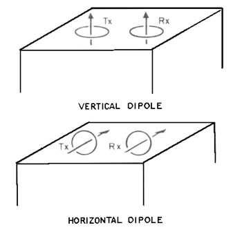
Frequency domain electromagnetics, commonly referred to as ground conductivity, measures the electrical conductivity of soil and rock by measuring the magnitude and phase of an induced electromagnetic current. Secondary electromagnetic fields generated by conductors are also detected and can be used to locate ferrous and nonferrous metal objects.
Frequency domain electromagnetics can effectively delineate:
- Lateral variations in the lithology of soils and rocks
- Near-surface structures (faults)
- Metallic objects (tanks, drums, and pipelines)
A ground conductivity instrument induces currents, generated by a varying electromagnetic field, into the subsurface in such a manner that their amplitude is linearly proportional to the ground conductivity. These instruments provide bulk measurements of apparent conductivity values integrated over a volume of the subsurface.
Factors affecting ground conductivity include the constituents, structure, and moisture content of the soil or rock. Most soil and rock constituents (such as quartz, feldspar, mica, and iron and aluminum oxide coatings) are electrical insulators of very high resistivity.
In general, ground conductivity is electrolytic and takes place through the moisture-filled pores and passages contained within the insulating soil and rock matrix. Therefore, the conductivity of both soils and rocks is a function of:
- Porosity
- Moisture content
- Concentration of dissolved electrolytes in the contained moisture
- Temperature and phase state of the pore water
- Amount and composition of colloids
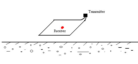
Transient electromagnetic (TEM) methods, also known as time-domain electromagnetics, measure the electrical conductivity of soil and rock by inducing pulsating currents in the ground with a transmitter coil and monitoring the decay of the induced current over time with a separate receiver coil. Multiple one-dimensional soundings are used to generate two- and three-dimensional images of the subsurface.
- Metal Detector (EM61)
The time-domain electromagnetic system is capable of detecting buried metal objects. It transmits a pulsed electromagnetic field into the ground, which induces eddy currents in buried metallic objects. These eddy currents generate secondary electromagnetic fields that are detected by the system. The time duration or decay rate, of the secondary EM field is related to the electrical conductivity characteristics of the buried object.
- TEM Sounding
TEM sounding is the method that the readings are taken at the center of the transmitting loop, which provides 1D resistivity data with the best depth penetration.
- TEM Profiling
TEM profiling is the technique that readings are taken along the survey lines perpendicular to the long side of the transmitting loop, which provide the locations of shallow conductors.