Faults in bedrock can be located with seismic methods, electrical resistivity imaging, VLF, and electromagnetics (EM34, MAXMIN,
, etc.)
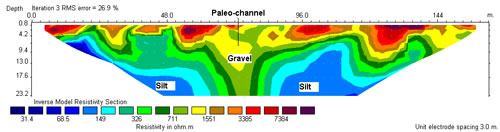
The coarse materials (sand and gravels) in buried river channels are more resistive than fine materials. Electrical resistivity imaging (ERI), electromagnetics, seismic methods, and gravity are commonly used. An example of ERI section over a buried river channel is shown below.
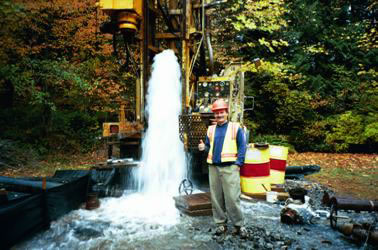
The coarse materials (sand and gravels) in aquifers are more resistive than fine materials. Electrical resistivity imaging (ERI), downhole PROTEM and electromagnetic (EM) sounding or profiling are commonly used to locate aquifers.
Salt water is much less resistive than fresh water. Electrical resistivity imaging (ERI) for shallow target and time-domain electromagnetics for deep target are commonly used to delineate salt water intrusion.
Borehole loggings, such as caliper, optical/acoustic televiewer, flow temperature/resistivity, and flow meter, provide insight information about ground water flow patterns, flow direction and rate.