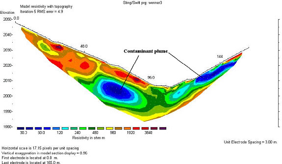
Near-surface geophysics is commonly used for the mapping of contaminant plumes. Geophysical methods are used either for the direct mapping of contaminants themselves, or indirectly, for the assessment of the natural geological and hydrogeologic conditions which dictate groundwater flow. These conditions include fractures, faults, stratigraphy, buried channels and natural geological lows in the bedrock or in clay aquitards controlling the migration of the contaminants.
With the growth in urban areas and the remediation of old landfills, the mapping and characterization of existing landfills has become a priority at many sites. Geophysical methods can delineate the lateral and vertical extents of the landfills and evaluate their impacts to groundwater, which are critical information to the remediation efforts and land reuse.
This application includes detecting leaks in landfill liner, petroleum tank farm liner, dam, gas pipeline, and water main.
Detection of underground storage tanks (UST) and buried metal waste at landfill sites is a common geophysical application.
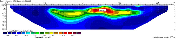
The contaminant migration pathway is determined by groundwater gradient and geological conditions, such as fractures and faults in bedrock, dipping direction and dipping angle of fractures and joints, and gravels.